5 Create object type
← 4 Build pipeline / ↑ 3.2 Foundry QS0 / → 6 Display in Maps
Converted 2026-11-19 04:30 PM EST
In this dataset’s upper-right toolbar:
Open All actions.
Select Create object type.
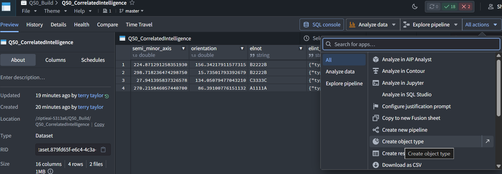
We’ll configure:
-
Name: QS0 Correlated Intelligence
-
Primary key: track_id
-
Title: elnot
-
Backing dataset: this QS0_CorrelatedIntelligence dataset
Show the creation screen before saving. We’ll also verify the geographic property types so Maps can display the objects.
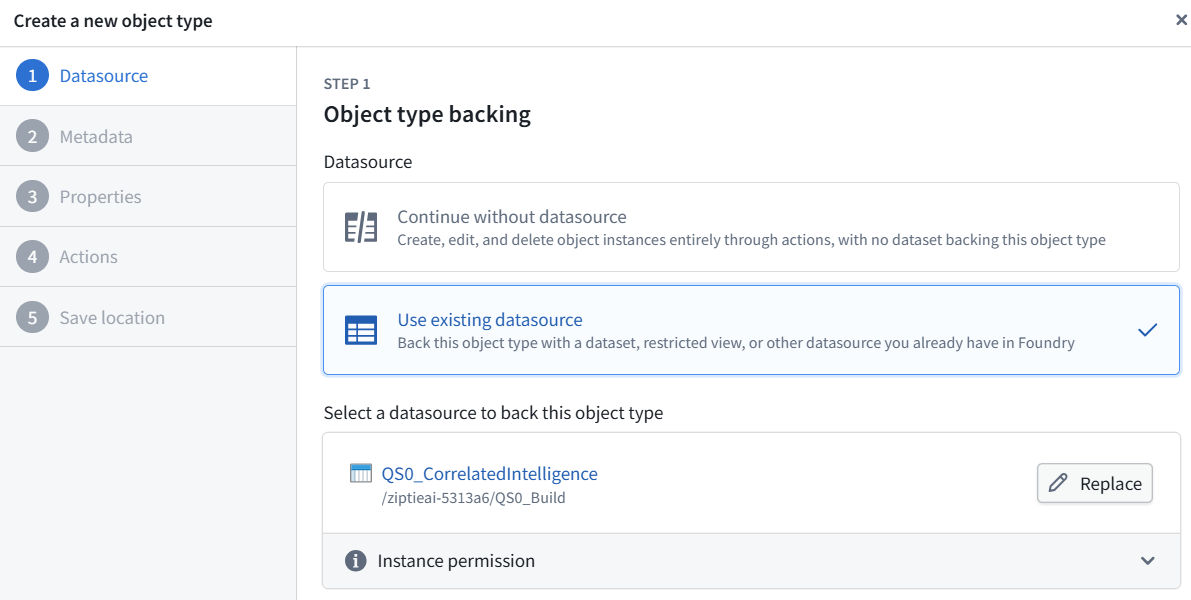
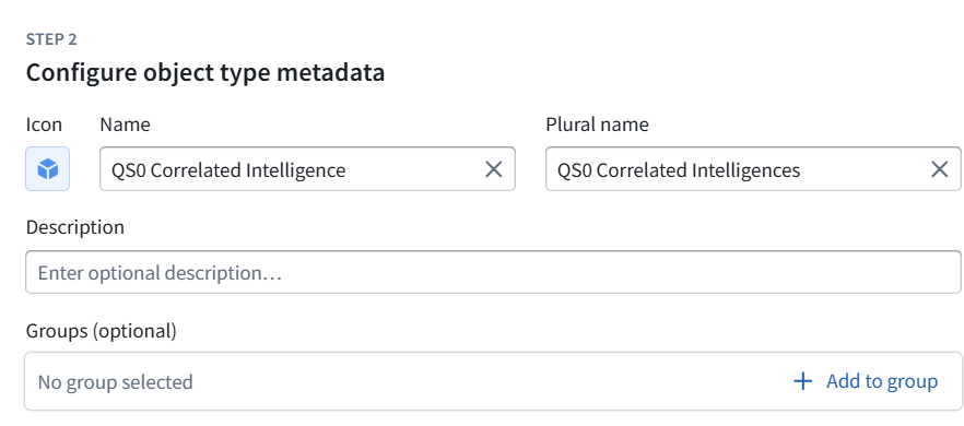
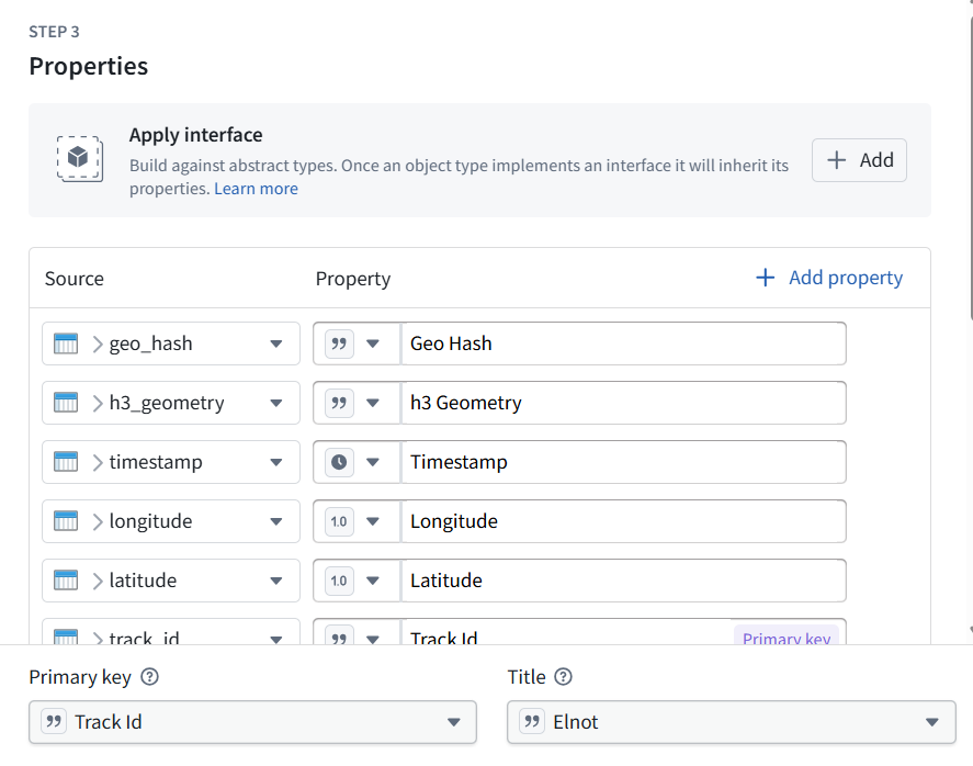
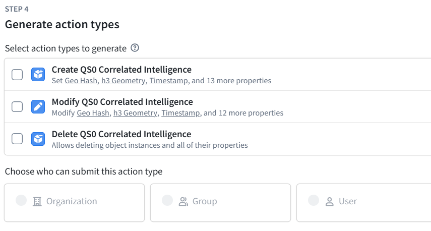
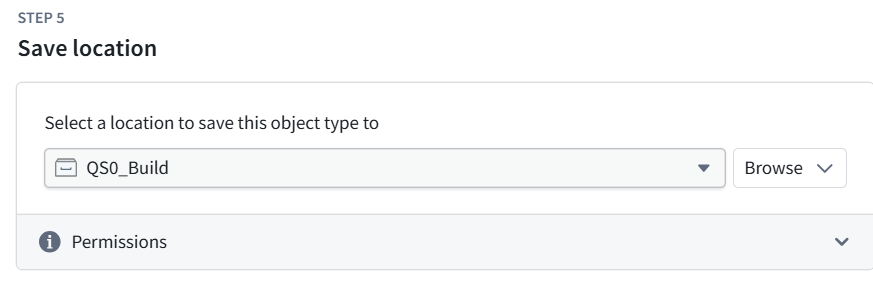
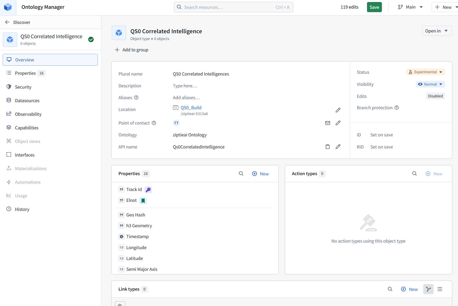
The name, location, primary key, and title are correct:
-
Name: QS0 Correlated Intelligence
-
Location: QS0_Build
-
Primary key: Track Id
-
Title: Elnot
Before saving, we need to fix the geographic property types. The screenshot shows Geo Hash and h3 Geometry currently imported as Strings.
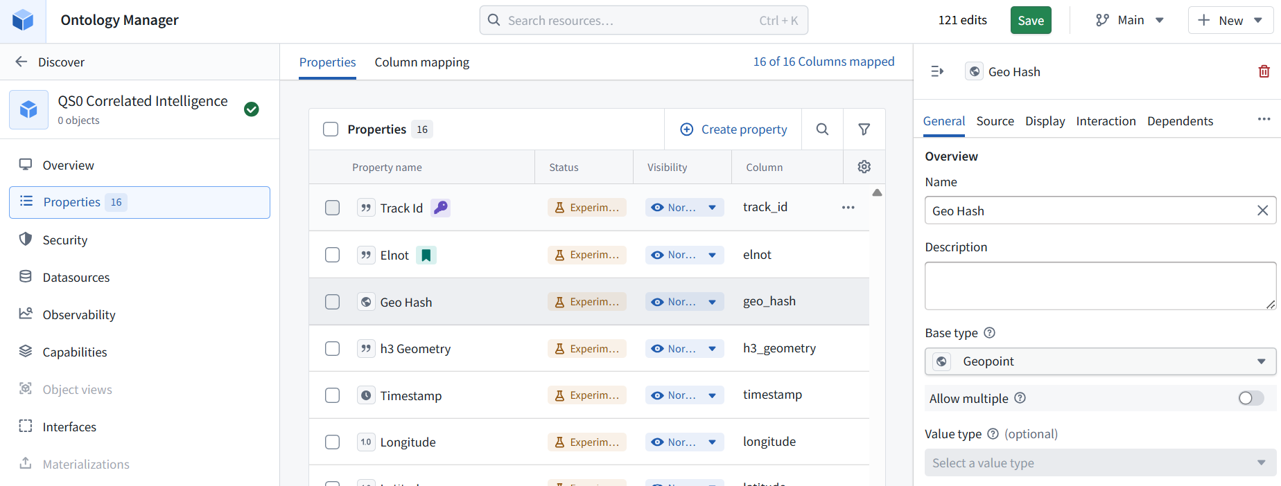
1. Click Properties in the left sidebar.
2. Select Geo Hash.
3. Open its Base type dropdown and show the options.
We’ll configure:
-
Geo Hash → Geopoint
-
h3 Geometry → Geoshape
-
Elint Geometry → Geoshape
These types tell Maps how to interpret the stored coordinates and polygons.
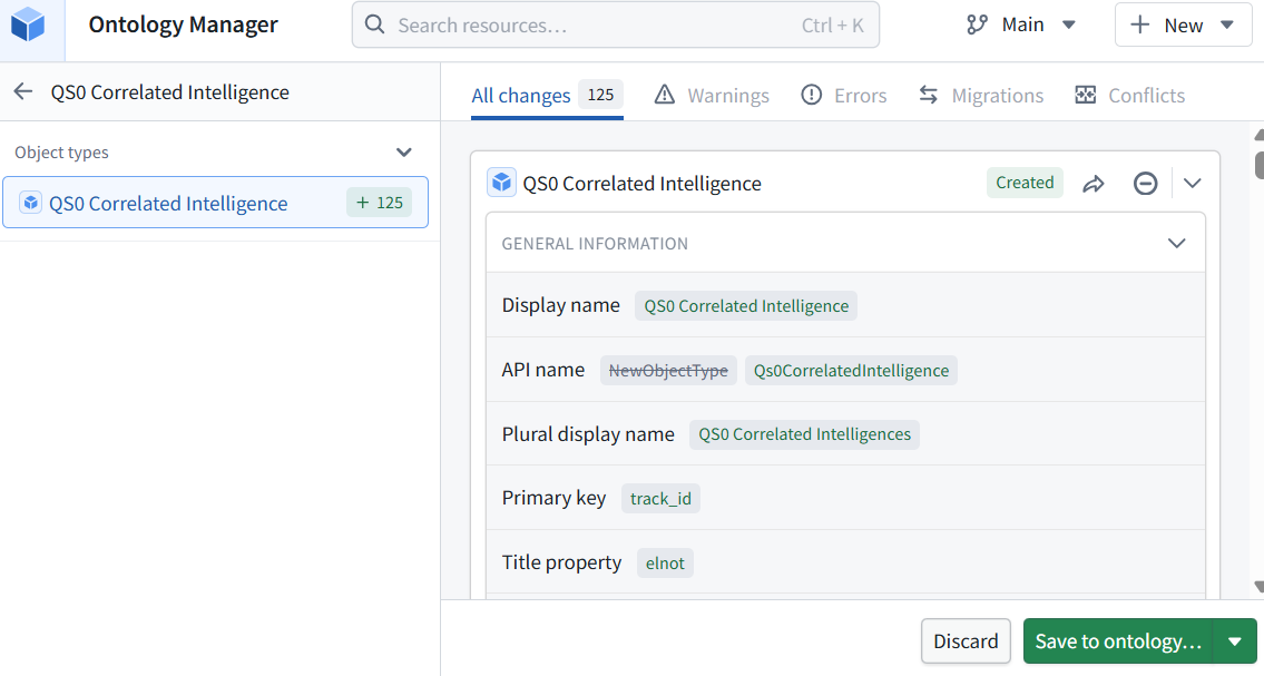
4. Yes—click Save to ontology… at the bottom right. This is the confirmation step that persists the new object type and its property definitions. The 125 changes are individual configuration changes for this one object type—not 125 objects. Follow any final confirmation prompt.
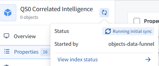
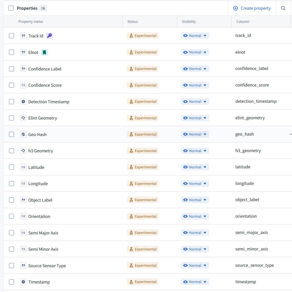
Yes—this property list is correct. No further changes are needed here.
The key settings are:
| Property | Correct configuration |
|---|---|
| Track Id | Primary key—the purple key icon |
| Elnot | Display title—the green bookmark icon |
| Geo Hash | Geopoint—the globe icon |
| Elint Geometry | Geoshape—the shape icon |
| h3 Geometry | Geoshape—the shape icon |
| Timestamp / Detection Timestamp | Timestamp—the clock icons |
Experimental is a lifecycle label, not an error. Leave it unchanged.
Next—just verify the objects
5. Click Overview in the left sidebar. Wait for indexing, then check whether it shows 4 objects. Show that screen.
Why an icon? Why not a column? A visible “Base type” column would be much clearer. It would let you verify String, Geopoint, Geoshape, Timestamp, etc., without memorizing icons or opening each property. I don’t know why this view uses icons instead. Your confusion is reasonable—I should have named the types explicitly rather than treating the icons as self-explanatory.